We left our B&B in Asheville this morning. We’ll miss some aspects of the Inn: the cozy feeling, the bright room, the friendly hosts and other guests. We won’t miss the breakfasts served family style; not the family style, but the food itself. This morning was some sort of quiche or omelette with corn. I ate it, Sally pretended. And not the uncomfortable chairs in our room, which were okay for lying back and sleeping but not for sitting and reading, watching TV or eating.
Today’s plan was simple: drive about 100 miles up the Blue Ridge Parkway to Blowing Rock, NC. The Blue Ridge Parkway is a “National Parkway”(1) that runs 469 miles through North Carolina and Virginia. It is two lanes the whole way, with numerous scenic overview cutouts and other places to stop and enjoy the outdoors. It has been the most visited unit of the National Park Service almost every year since 1946. It mostly follows the Blue Ridge of the Appalachian Mountains.
We entered at Mile Post 385, and plan to follow it to MP 0.
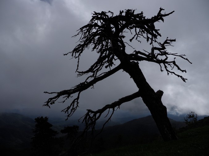
Great tree along the Parkway, September 2018
As this was our first time on the Parkway, we weren’t quite sure what to expect. My best guess was that it’s like driving through any of the big National Parks out west, only longer. We stopped at some scenic turnouts, and then at a couple of specific sites.

Craggy Gardens looking east, September 2018
Craggy Gardens was the first stop, and the first time I went to the wrong viewpoint initially. I stopped at the picnic area, and saw a sign for a trail heading to the viewpoint almost a mile up the hill. Fortunately, I turned back after a short while as the sky looked completely socked in. After heading back out on the Parkway, we came to the viewpoint – right on the highway. No hiking required!

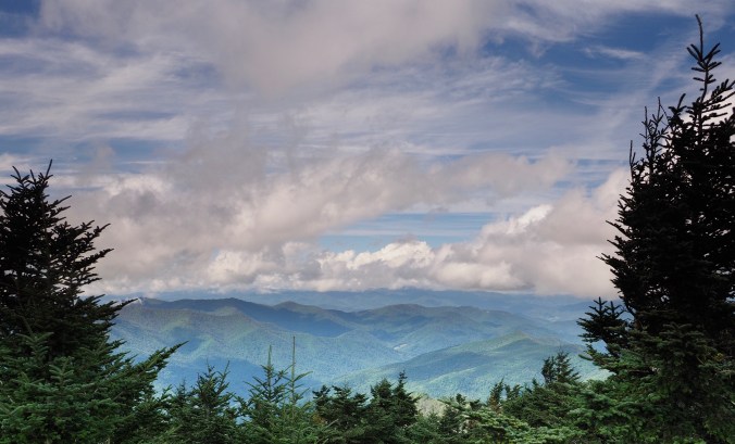
Looking west from Craggy Gardens Viewpoint, September 2018
Our next stop was Mount Mitchell, which at 6,684′ is the highest peak east of the Mississippi (2).
View from the top (of Mt. Mitchell), September 2018
On our way up to the peak, we stopped for lunch in the state park that surrounds the mountain. It was simple and edible. The views from the peak were very nice (3).

Linville Falls, September 2018
The last major stop was Linville Falls. Again I managed to go to the wrong viewpoint first. In fact, I managed to go to both of the viewpoints I didn’t want before finding the one I wanted. And believe me, the trail signs couldn’t have been more clear. I was just not reading them correctly.
We finished today at our stop for the night, the Chetola Resort. To get this far on the trip, we’ve driven just over 2,000 miles, averaging almost 60 mph and 28.7 mpg. Today we averaged 34 mph and 19.5 mpg over 110 miles. To say life moves slower on the Blue Ridge Parkway is an understatement.
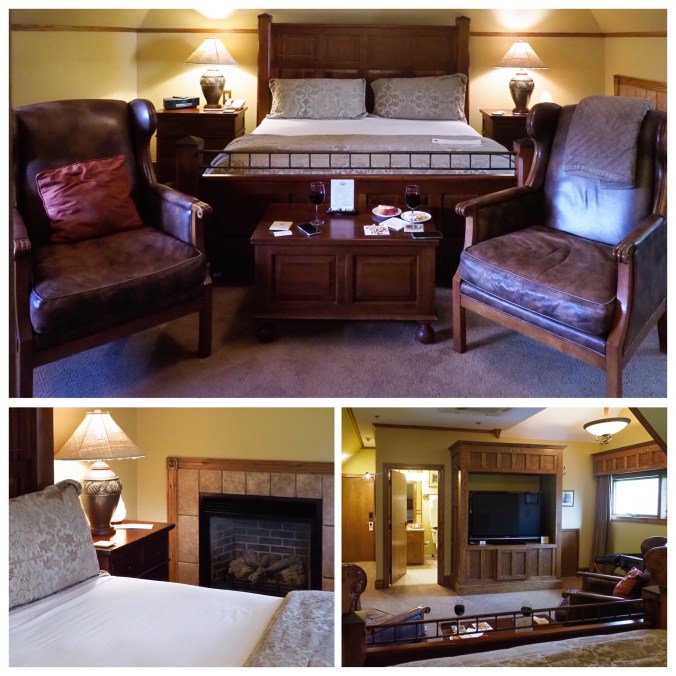
Chetola Resort, September 2018
The resort is a pleasant surprise. Their online pictures don’t do our room justice (4). There were drinks and snacks on the hall when we arrived, and we had a nice dinner in the restaurant downstairs. No need to search for a place to eat!
(1) A National Parkway is like a National Forest or National Monument. It is administered by the National Park Service.
(2) Mt. Washington is #11 at 6,288′. All of the top ten are in the Blue Ridge area.
(3) I actually stopped in the parking lot below the peak. But not very far below.
(4) I think mine are better, but you can be the judge.
